- Free State Online
- Departments
- Office of the Premier
- Agriculture & Rural Development
- Education
- Health
- Coorporative Governance & Traditional Affairs
- Public Works & Infrastructure
- Police, Roads & Transport
- Social Development
- Sport, Art, Culture and Recreation
- Economic, Small Business Development, Tourism & Environmental Affairs
- Human Settlements
- Treasury
- Municipalities
- Entities
Profile of the Municipality
The Letsemeng Local Municipality is situated in the south-western Free State and forms parts of the Xhariep district. It has a surface area of 10 192 square kilometres, which is 29, 8% of the total Xhariep surface area. According to Census 2011, Letsemeng Local Municipality has a total population of 38 628, of whom 67,8% are black African, 23,4% are coloured and 8,1% are white, with the other population groups making up the remaining 0,7%. The five towns situated in Letsemeng are Koffiefontein (Municipal Head Office), Jacobsdal, Luckhoff, Oppermansgronde and Petrusburg.
Towns of Letsemeng
Koffiefontein
Koffiefontein was originally a diamond-diggers’ camp and was proclaimed a town in 1892. It is located on the banks of the Riet River. The name of the town literally means ‘coffee fountain’ in Afrikaans. Koffiefontein/Ditlhake serves as the municipal administrative seat within Letsemeng. According to census 2011, the total population of Koffiefontein is 10,402. The town is situated approximately 125 km northwest of Trompsburg and an estimated 146 km east of Bloemfontein. The transport riders travelling through this area were prone to stop for a coffee break at the spring in this vicinity. This area therefore became known as Koffiefontein. In 1870, one the riders found a diamond near the spring and this set off a rush for prospective diamond hunters. The settlement grew and maintained its original name and by 1882 was considered a boom town with four mining companies working the area. Koffiefontein was awarded municipal status in 1892.
The 2nd World War saw Koffiefontein as a prisoner-of-war camp for Italian soldiers. Pro-Nazi South Africans were also interned here. They left their mark in the form of large outdoor paintings of Victor Emanuele and Benito Mussolini.

Diamond Mining
Koffiefontein is one of the five producing mines in the Petra Diamonds group – a leading supplier of rough diamonds. Koffiefontein is one of the world’s top kimberlite mines by average value per carat. The mine produces high-value diamonds, a regular proportion of which are beautiful white diamonds between 5 and 30 carats in size. The average value per carat achieved in the financial year to June 2009 was US$252, which is high compared to the world’s kimberlite mines. In 1994, a 232.34 carat diamond was recovered at Koffiefontein, being the largest rough diamond ever produced by the mine.
Petra acquired Koffiefontein in July 2007 from De Beers for R81.9 million and, having conducted care and maintenance activities at the mine in the 12 months prior to completion, was able to bring the mine on stream immediately. This acquisition marked the initial implementation of Petra’s strategy to become a significant diamond producer as historically, production had been solely from the Group’s fissure mines. The acquisition has proved to be exceptional for Petra as Koffiefontein is now a major contributor to Group revenue, and its high-value production is highly sought after in the international diamond market.

Petrusburg
Petrusburg was named after Petrus Albertus Venter whose estate provided the money to buy the farm Diepfontein, on which the town was laid out in 1891 as a church and commercial centre for an extensive farming area. It is situated on the N8 National Route between Bloemfontein (80 km east) and Kimberley (80 km west). According to the 2011 census the total population of Petrusburg is 8,435. Mixed farming is practised in the 3000 square km which was excised from the Fauresmith district in 1863. The main activity is sheep farming. The main crops are maize and potatoes. Modest quantities of wheat are harvested in the rare season when enough rain falls in winter and early spring. There are numerous salt pans in the district. The centre point of South Africa is situated approximately 20 km outside the town.
Petrusburg/Bolokanang serves as a commercial and social service centre within Letsemeng. It is situated approximately 55 km northeast of Koffiefontein. The main social and economic functions of the town include: main regional agro-processing centre, secondary agricultural service centre, social functions such as residence, education and medical services and transport support services on major routes. As is the case with many other towns in the Free State, Petrusburg has a number of historical sites. These include the Paardeberg Anglo Boer-War Museum located 23 km outside of town. The Poplar Grove Battle, where Christiaan de Wet tried unsuccessfully to prevent British advancement into Bloemfontein, is one of many battles that were fought in the area.

Jacobsdal
Jacobsdal is located on the banks of the Riet River. It was laid out on the farm Kalkfontein in 1859 and was named after the owner of this land, Christoffel Johannes Jacobs. According to the 2011 census Jacobsdal has a total population of 3,504. Jacobsdal/Ratanang serves as an economic growth and tourism development node within Letsemeng. It is situated approximately 45 km northwest of Koffiefontein.
Landzicht Winery
Located at Jacobsdal, the Landzicht Wine Cellar opened in 1974. Owned by GWK Limited and producers, it annually presses ± 3 000 tons of grapes, producing ± 2.4m litres of wine. A new bottling plant using the latest technology was opened in April 2005 as a black empowerment project. Amongst the premium wines produced from pure certified cultivars are 5 whites, 4 reds, 1 Rosé and several fortifieds such as White Muscadel and Ruby Port. Landzicht wine labels range among the best in South Africa having won several Veritas, SA Youngwine Show and Michaelangelo awards. The Winery offers cellar tours and wine tasting.

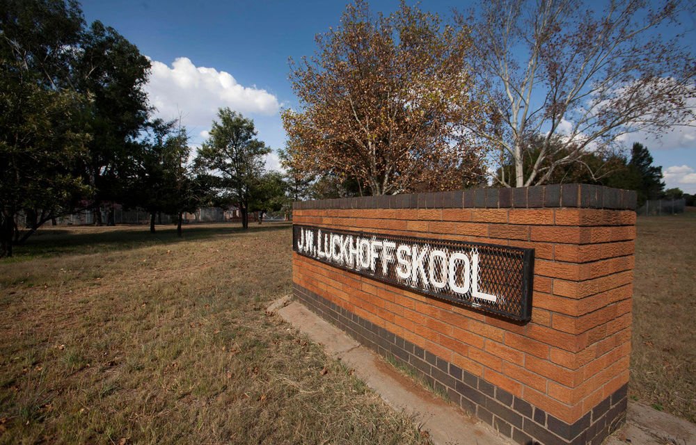
Luckhoff
Luckhoff was established on the farm Koffiekuil in 1892 and it was probably named after Heinrich Jacob Luckhoff (1842-1943), Minister of the Dutch Reformed Church in Fauresmith at that time. The town is located 82 km north-west of Philippolis and 56 km west of Fauresmith. According to census 2011 the total population of Luckhoff is 3,699.
Oppermansgronde
Oppermansgronde is situated in the south-western Free State Province within the Xhariep District. It is bordered in the North by the Lejweleputswa District, in the South by Kopanong, in the East by the Mangaung Metro, and in the West by the Northern Cape Province. According to census 2011, the total population of oppermansgronde is 971.
For more information on Letsemeng Local Municipality Profile(residents info) visit the stats sa website: Stats SA – Letsemeng Local Municipality Residents Info